top of page


Stream Clean Up MAPS !!
Use the Overview Map to see ALL Sterling Stream Cleanup locations at a glance, then click any of the seven individual cleanup maps for details about specific stream sections and cleanup areas. These maps help volunteers and community members navigate and support the Sterling Foundation’s Stream Cleanup effort.

MAP Stream Clean Up Site Overview


MAP Site #1: W. Holly Ave. – Sterling Middle School Track


MAP Site #2: W. Maple Ave. – Behind Sterling Golf Course


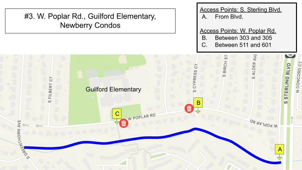
MAP Site #3: W. Poplar Rd., Guilford Elementary, Newberry Condos

MAP Site #4: E. Staunton Ave. – Butterfly Garden


MAP Site #5: Enterprise St., Food Lion, Community Center


MAP Site #6: N. Fillmore Ave. – Church Mills HOA


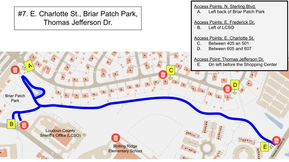
MAP Site #7: E. Charlotte St. – Briar Patch Park
bottom of page